


Some 10 years ago, Jerry Roberts, then director of the Connecticut River Museum, looked up at Tom Walsh flying over the Essex docks in his yellow Piper Cub.
“One of the coolest things I saw Tom do before I knew him very well was at the River Museum,” says Roberts. “I guess it was Memorial Day or something. He’s flying in his Piper Cub pretty low, and the time I saw him do it, he dropped this wreath and it landed right off the end of the dock. It was amazing.”
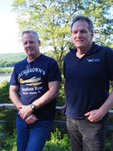
Walsh laughs. The aerial photographer has since come to know the historian quite well. After meeting at the Essex waterfront, the two men began working together, beginning in 2009. Walsh, an international airline pilot, photographed Connecticut’s 410-mile namesake river from the air for an exhibit Roberts would create for the museum.
“He asked if I had any shots of the river that they could use,” says Walsh. “And I said, ‘Well as a matter of fact, yes, but I’d like to fly the whole river.’ They provided the funding, and I flew the whole river, from the source to the south and back again, all the way up. As I went further north, it got wilder and wilder, and I had never seen any of this before either, so it was like an exploration. That was the initial idea of a book at some point in the future.”
The exhibit was a success. Roberts continued to contact Walsh for subsequent projects, including one multi-year quest to uncover the truth behind the “British Raid on Essex” during the War of 1812. (Roberts then authored a book of Some 10 years ago, Jerry Roberts, then director of the Connecticut River Museum, looked up at Tom Walsh flying over the Essex docks in his yellow Piper Cub.

“One of the coolest things I saw Tom do before I knew him very well was at the River Museum,” says Roberts. “I guess it was Memorial Day or something. He’s flying in his Piper Cub pretty low, and the time I saw him do it, he dropped this wreath and it landed right off the end of the dock. It was amazing.”
Walsh laughs. The aerial photographer has since come to know the historian quite well. After meeting at the Essex waterfront, the two men began working together, beginning in 2009. Walsh, an international airline pilot, photographed Connecticut’s 410-mile namesake river from the air for an exhibit Roberts would create for the museum.
“He asked if I had any shots of the river that they could use,” says Walsh. “And I said, ‘Well as a matter of fact, yes, but I’d like to fly the whole river.’ They provided the funding, and I flew the whole river, from the source to the south and back again, all the way up. As I went further north, it got wilder and wilder, and I had never seen any of this before either, so it was like an exploration. That was the initial idea of a book at some point in the future.”

The exhibit was a success. Roberts continued to contact Walsh for subsequent projects, including one multi-year quest to uncover the truth behind the “British Raid on Essex” during the War of 1812. (Roberts then authored a book of the same name.) All the while, the idea of creating a book together simmered. Two years ago, everything fell into place. They found a publisher and began the earnest work to make their vision a reality. In August, Globe Pequot Press released The Connecticut River from the Air: An Intimate Perspective of New England’s Historic Waterway, penned by Roberts with stunning aerial images captured by Walsh. One working from the past, the other from the sky, the two men created a 256-page chronicle that flies high above and dives deep into the Connecticut River and the towns along its shores.
On the face of it, Roberts and Walsh seem like polar opposites. Roberts is a research-driven historian, author and accomplished museum executive, specializing in exhibit design. He served as vice-president at the Intrepid Sea Air Space Museum in New York City, and executive director at both the Connecticut River Museum and the New England Air Museum at Bradley International Airport. He is now a full-time writer and museum consultant.

Walsh explores and photographs intuitively from the air. He began flying at a young age and went on to become a fighter pilot in the United States Marine Corps before beginning his now 31-year career as a pilot for an international airline. In 2004, he formed Shoreline Aerial Photography to capture bird’s eye view images for corporations, government agencies, publications and individuals. (He photographed New Haven’s Q bridge monthly for five years while it was under construction.) He continues his aerial photography when time allows.
When the men sit down together on Roberts’ Deep River deck some 200 feet above a bend in the Connecticut River, it’s easy to see their common ground. Walsh, 60, moved to Ivoryton from Atlanta in 1997, and married on the docks at the Connecticut River Museum. Roberts, 63, arrived for the Connecticut River Museum job in 2006 after 30 years in Manhattan, living on the Hudson River. Each with a keen interest in the Connecticut River, it was inevitable that they would meet.
Roberts writes that one of his fantasies when he lived in Manhattan was to live in a small New England village and walk down to the docks with a cup of coffee and shoot the breeze with local sailors and fisherman. “While I have, in fact, met plenty of New England Yankees and characters straight out of Central Casting, one of the most interesting locals I bumped into turned out to be an unexpected catch. Tom Walsh is not a sailor or a fisherman. He is a pilot,” Roberts writes.
Their collaboration has coursed as naturally as the river itself. Walsh brought Roberts back into the sky after a decades-old decision to limit flying lessons due to the demands of the deep diving he was doing at the time. As for Walsh, his interest in history is constantly fed by Roberts. The two are already brainstorming future projects.
Perched on the deck above the tree line, chimes blowing in the breeze and an occasional plane humming over the river (“There’s a Piper Cub,” Walsh points out), their conversation soars, submerges, glides and ultimately lands on the banks of New England’s longest river. They pore over pages that have just been sent to print, reminiscing about the shared work that resulted in a book that is beautiful to the eye and fascinating to read.
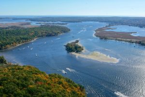
The introduction begins: “From a remote pond less than three hundred yards from the Canadian border, New England’s great river begins its four hundred and ten mile journey to the sea.” With some 300 aerial photographs throughout, it begins at the river’s mouth at Long Island Sound.
“Originally, even as I did this exhibit at the Connecticut River Museum, I was going to follow a theoretical drop of water,” says Roberts. “In the end, we decided it’s best to do exploration just like Tom flew it, just like [17th century Dutch explorer] Adriaen Block explored the river. The first encounter that you have is the Long Island Sound and the jetties at the mouth of the river.”
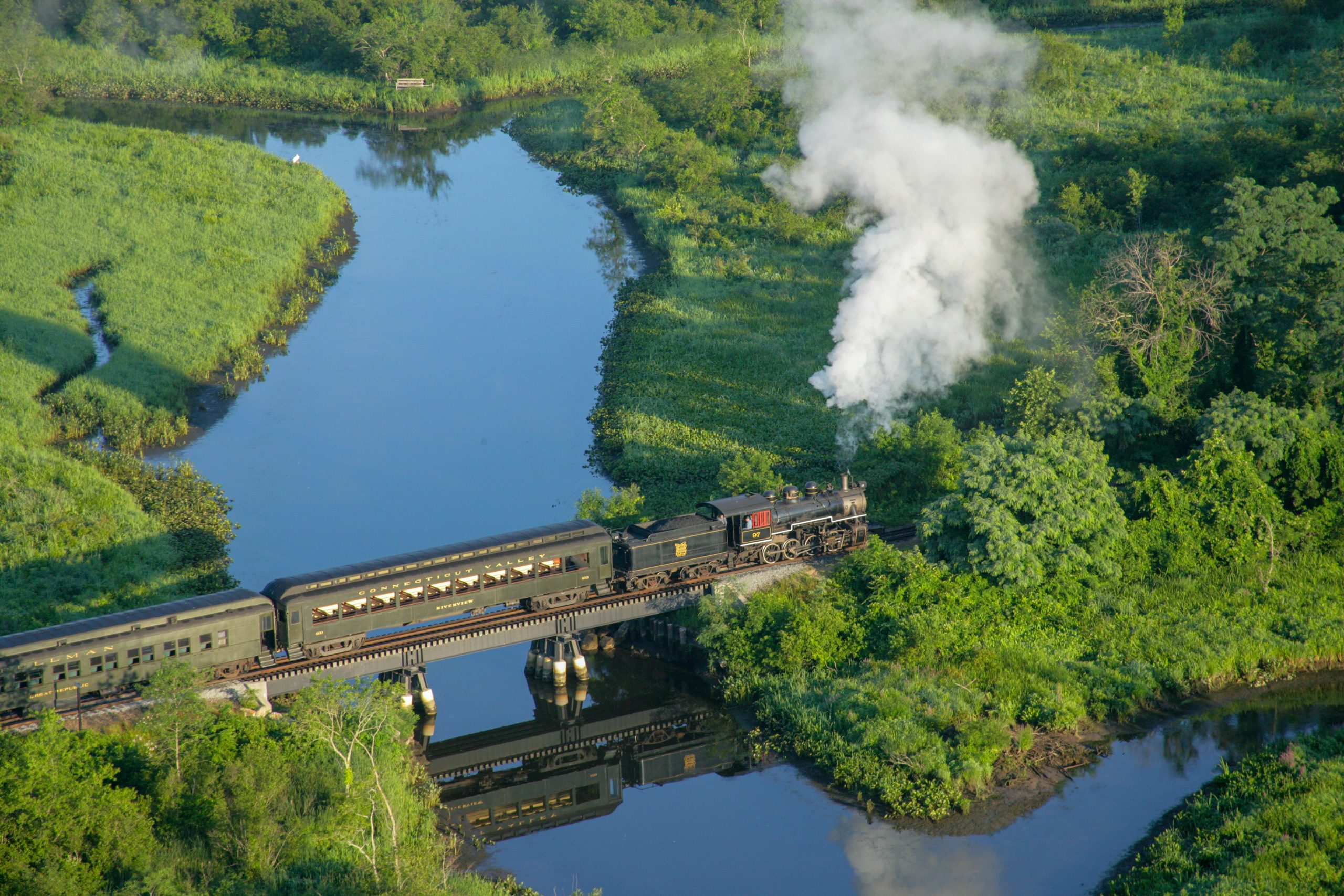
In Old Saybrook, the pages very quickly dive into the kind of surprises that surfaced during their work. As Walsh was flying, he noticed a shape just beneath the water at the entrance to North Cove. He zoomed in to photograph the timbers of a sunken hull sticking out from the remnants of an old railroad causeway. The story is told – replete with an additional photo of the living ship – of how the 300-foot steamboat Granite Spray burned upriver in 1883 and was towed to this resting spot. It still occasionally breaks the surface at low tide.
“
People pass this all the time; they probably don’t even know this is there,” says Roberts.
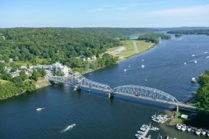
The stories climb ashore to the cities and towns in the four states where the Connecticut River runs its course. There are the well-known cities, such as Middletown, Hartford and Springfield, and there are towns and bridges (more than 80) with their own claim to fame: Sunderland, Mass., with the Cyclops corn maze that Walsh had not even realized he photographed; Brattleboro, Vermont, where the largest producer of pipe organs was once located and not far from where Rudyard Kipling wrote The Jungle Book; the Cornish-Windsor Bridge, the longest covered bridge in the country; and the Ledyard Bridge in New Hampshire, near where the Camp Fire Girls first organized. With the help of research by his wife, Roberts found another story of that bridge – the Ledyard Challenge.
“It’s been going on since the 1800s,” says Roberts. “Freshmen come down from the campus, down to the riverbank. This is Dartmouth right in the hills here, so they come down, they strip naked, hide their clothes in the bushes, swim across the river, come up on this side, then run back across the bridge naked and get their clothes before the police can arrest them. Happens every year. They don’t announce when it is.”
Roberts accompanied Walsh on shorter flights, including one over Bradley International Airport. He writes about Walsh’s calm demeanor: “Here we were in our sparrow-like amphibian, orbiting above the runways as sleek jets came and went to destinations near and far. It was all pretty extraordinary to me, but just another day in the air for Tom.”
Walsh’s river-length flights were done alone. He’d find a place to stay overnight before making the return trip the following day. Some of his earliest images were taken from a Piper Cub, which he sold. He now owns a Cessna Cardinal and a SeaRey amphibian for his work, using gyrostabilizers with high-end cameras. Walsh shot thousands of photographs of the river, which he and Roberts had to whittle down for the book.
“We had to discard some phenomenal pictures,” says Roberts, detailing a photo they almost cut until they realized that what they were looking at was three sunken barges that had grown into islands: “They were probably moored and abandoned there, laying there for decades. And literally, that picture was going to go on the cutting room floor until we noticed something odd about those islands. So that happened many times.”

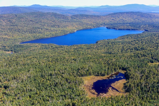
Both are fascinated with the river’s many oxbows – switchbacks that create undulating patterns and leave behind crescent-shaped lakes. They make artistic images and also reveal the history of the river.
“I was always attracted to the oxbows,” says Walsh. “I love history, and what you are looking at is hundreds and hundreds of years of history in one glance. It was surprising to me how often the river changed course and is still changing course up there [in the north], and I don’t think people realize that.”
The final section of the book heads into The Great North Woods, where Walsh ventured to the source of the Connecticut River. The terrain becomes rugged and uninhabited, and a series of lakes emerges: the First, Second, Third and Fourth Connecticut lakes, labeled from south to north. It is the Fourth Connecticut Lake in New Hampshire, just below a ridge where a U.S. Customs station sits at the Canadian border, that is the source of the Connecticut River. Just 528 feet long, it features a floating bog with insect-eating plants.
Walsh was so intrigued that he rode his motorcycle to the Customs station and hiked the trail to the source of the river. There, he stepped across one end as easily as if it were a puddle.
Photography courtesy of Tom WALSH
More Stories
Over 50, Underestimated: The Grandfluencers Redefining Age on Social Media
Building Resilient Businesses: Strategies for Success
Summer Means Convertibles